VIDEO Record Snowfall in WindsorEssex

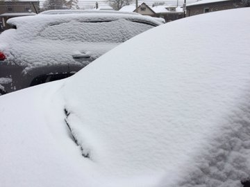
Monday's snowfall in Windsor-Essex was record breaking.
According to Environment Canada Meteorologist Peter Kimball, between 15 and 20 centimetres of snow fell on Monday, November 11, 2019, breaking the record dating back to 1984.
Officially at the Windsor Airport, there was 14.7mm of "liquid equivalent" — which is snow that has already melted down.
Speaking on AM800's the Morning Drive, Kimball says it also looks like the snow is here to stay.
"It is already the middle of November and even if we get a mild spell next week which is forecast for Windsor, looking at the forecast, Sunday +7C and Monday +8C, it does take quite a bit to melt all that," he says.
Kimball says the cold temperatures will stick around for the next few days with a high of -1C on Wednesday, which is still well below normal, then a high of +2C on Thursday and Friday.
"Tomorrow's high of -1C, still way below normal, high of +2, then +2 on Thursday and Friday and then up to +7 on Sunday."
Kimball says we need to accept the fact that it is the middle of November.
"We might get close to normal but the normal high this time of the year, it starts dropping like a rock,"he says. "It is the middle of November so as we go forward, if we do have a warmer than normal, that normal is going down."
On the positive side, there doesn't appear to be any more significant snowfall in the forecast for the near future.
